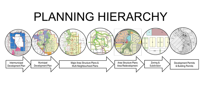
Major Area Structure Plans
There are four major area structure plans in Red Deer. Major Area Structure Plans are long range land use planning tool that will usually encompass a large land area. MASP’s are prepared by The City of Red Deer and are approved by City Council.
East Hill Major Area Structure Plan
East Hill Major Area Structure Plan (MASP) outlines the broad, long term transportation and land use development strategy for land in east Red Deer.
North of 11A Major Area Structure Plan
The North of 11A Major Area Structure Plan outlines the broad long term transportation and land use strategy for the land in North Red Deer, which was part of the lands annexed in 2009.
West QE2 Major Area Structure Plan
The West QE2 Major Area Structure Plan area is located in the north / west of Red Deer to the east of the Queen Elizabeth highway. The plan outlines the policy framework for industrial development in the area.
Northwest Major Area Structure Plan
This plan is located in the northwest and includes the residential neighbourhoods of Kentwood, Oriole Park West, Glendale and Johnstone Park. The plan also includes the Edgar Industrial and parts of the Golden West Industrial area.